


mYard is a personal geo-tagging tool intended for outdoor use. mYard was developed as a property and grounds management tool to geo-tag landscape, garden, and grounds features. mYard is applicable to many uses requiring the organized recording of outdoor locations with detailed information and aids for finding them again.
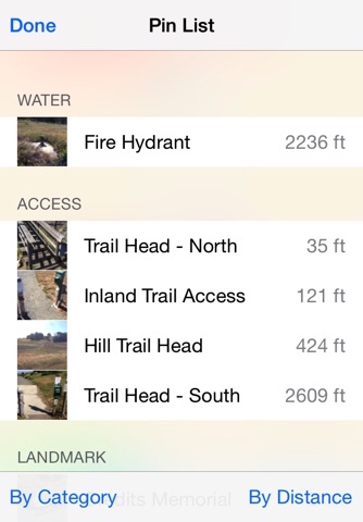
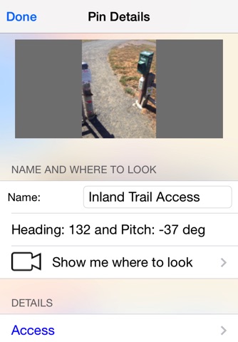
mYard is used to record locations of interest as annotated pins on a map, including photo and detailed notes. It provides distances from current location and distances between recorded pins. Location details can be managed with customized fields. Photo heading and pitch is saved and used in prompting where to look.
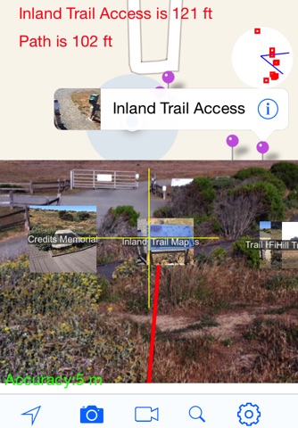
Two augmented reality tools feature video overlay with pin location prompts. Virtual View shows pin names and thumbnail when using location. Show Me View identifies pins that are nearby. Paths can be recorded, saved in the map, and used in making distance measurements. Pin names can be announced when nearby. Path recording and announcement work in the background, even when phone is locked.